North America
Maps based in North America.
115 files
-
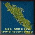
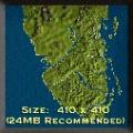
Goal: Vancouver Island, a large island with vast logging and coal resources.
Author's Comments: This Is my First Map. In case you don't know, Vancouver Island is on the west coast of British Columbia, Canada. It is fairly accurate in most details, but has had some industry added for good game play (I hope :) ).
By Guest141 0 -
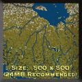
Goal: The railway boom has finally reached Ontario's northeastern frontier.
Population centres are small and spread out, but there's lots of forestry and mining out there. The problem is building through the wilds of the Canadian Shield and the swampy muskeg of the Sub-Arctic to link it all together. It's tough making a railway fortune out here - give it a shot anyhow!
This is an open map with no events or goals, just make money and beat your competition.
The map was created using satellite imagery and is reasonably accurate. Industries are set in appropriate centres and regions but:-
1) Aluminum/Bauxite = Nickel/Copper mining
2) Iron Mines = Iron/Zinc/Cobalt/Gold mines
3) Limited agriculture is accurate but pre-set in the smaller regions where it is found.
4) Snow around James Bay represents the added expense involved in laying rail in muskeg (snow is not year-round up there).
By Guest134 0 -
Goal: Railroading in Oklahoma.
Author's Comments: I wrote this map as my wife's family is from Oklahoma. Its not hard - I wanted it easy enough for my kids to play. Its based on a number of different maps I have of the state so the geography should be reasonably accurate. It features events like the two Oklahoma Land Runs, Oklahoma becoming a state, the World Fair in St. Louis and the depression of the 1930's.
It can be played on any version of Railroad Tycoon.
By Guest126 0 -
Goal: This is a high finance stock and merger map. In 1910 Seattle had many railroads that were ripe for takeover. As a tycoon you will consolidate all of the railroad operations.
Author's Comments: Consolidate the many railroad companies in the Seattle area into one. Become Seattle's first (but not last) billionaire.
A starter hint: Like in chess you need to plan ahead before you start. Like with the Great Northern or the Milwaukee Road, You must consume other railroads as you grow and be better at it than they were.
By Gwizz160 0 -
Goal: Southern Vancouver Island.
Author's Comments: Robert Dunsmuir builds the Esquimalt and Nanaimo - strictly a government give-a-way!
I tried to be historically and geographically as realistic as I could. My first attempt at a map.
By Guest116 0 -
Goal: There are no real goals in this scenario, just try to beat the competition. You'll have to deal with small grades practically everywhere. I suggest pausing at first and looking for a good spot to start.
Author's Comments: There are several upgrades in this map including a bunch more cities, some industries have been fixed, more labels and trees. Special thanks to Andrew Howes for helping me out with this map.
By Guest128 0 -
Goal: Spokane Transfer Yard is a builders map or AI win map. Requirements are to haul 11 different cargos in 20 years. They will be counted for the wins. Bronze easy & gold difficult.
Author's Comments: Spokane Transfer uses ports like they were a transfer yard. The map will use dialogs for giving instructions
By Gwizz124 0 -
Goal: Pennsylvania milk run by the square of time. Choose the easy game button or the hard game button then haul tons of milk and grain.
Author's Comments: Pennsylvania Milk Run is a Milk map. The map will use dialogs for giving instructions.
By Gwizz174 0 -
Goal: The social and economic development of Western Canada is inexorably entwined with its railways. No railway however has left a legacy as great and rich as the Kettle Valley Railway.
Author's Comments: The Kettle Valley Railway was a railroad that operated in South-Central British Columbia from the early 1900ths to 1964. It was a masterpiece of railroad construction and for many years was the primary link between the coast and the areas of South-Central B.C. The railroad operated under the control and direction of the CPR however it remained a separate entity in its operations for many years. The railroad was to ensure that the CPR dominance of the general area remained secured by preventing the Great Northern and James Hill to exploit the riches of the area.
Playing this map you will be in charge of a busy railway company with most of its trackage already built. Your main challenge will be to ensure that the KVR prospers and remains in existence past its actual demise in 1964. In fact you are invited to give the railroad "A Second Chance".
Map name: KVR 2.00 "A Second Chance"
Map Type : TSC/Gold
Map Size : 400x400
Additional Players : 16
Game Difficulty : Medal games for experienced players.
Map era : 1916 to 1964
Map Location : Canada
Map Restrictions : No setting the throttle, No starting of any new
companies, No customs at borders and Limited track building is in effect.
Comments: This map has two additional levels of game play besides that of the medal game. One level has a few of the medal game events to give you a taste of it and the other is just to play around without having to worry about any events (just enjoy the scenery).
Please also read the text file included with your download containing additional information and descriptions about the tasks and requirements.
By Guest147 0 -
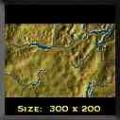
Goal: The Interior of British Columbia. Mountains, rivers, lakes, resources and a handful of towns and cities. It's ripe for the taking.
Author's Comments: This is a scenario involving the British Columbia Interior. I made this map by hand as I couldn't find a grey scale map of this area that was the right scale. The town of Chase is where I live, so I have tried to create a fairly representative idea of this area. The land and water features, relative elevations and town locations are as close as possible to the real thing. The industries are matched as closely as possible to actual occurrence with some degree of randomness to allow replayability. The map is playable on the expert level as well as the easy level.
This map has had some major changes. With the assistance of Sirian, all the raw materials and houses have been switched from hand-placed to random occurrences. This should correct most oversupply problems inherent in the first version. In addition, the game has been revamped for multiplayer. 2 extra ports have been added in order to allow players beginning at different edges of the map to have a more equal opportunity to build a workable railroad. A series of events (actual historical occurrences) has been added and will appear throughout the gameplay.
Thanks to Sirian for help in making this map a better one.
By Guest170 0 -
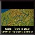
Goal: When rail was king the state of Pennsylvania was a battle ground for robber baron and visionary alike. Time to take your place on the battlefield.
Author's Comments: One of the maps found in the GOLD edition of the Railroad Tycoon.
By Guest151 0 -
Goal: San Fransisco is becoming glutted by automobiles. You've been called in to help. You will be creating the Bay Area Rapid Transit system.
By Guest125 0 -
Goal: This is a simple scenario of survival. It's a race against time. You are to make the Pittsburgh, Binghampton and Eastern survive the panic of 1907. After that, just out earn all competitors by 1915. There is not a silver or bronze win.
Author's Comments: This map starts the player in Canton, PA with the goal of reaching Towanda, PA. It's loosely based on the Pittsburgh, Binghampton and Eastern RR. The PBERR didn't survive the Panic of 1907 and only graded the line between the two towns. The grade is now PA route 414. It's a small area. There are only about 50 miles between Canton and Towanda, but many squares of the grid. The scenario's goal is to survive the Panic of 1907 and out earn all other competitors inside 10 years.
By Guest125 0 -
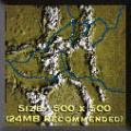
Goal: Your task is to cross the great ranges, extract minerals from the mountains and establish a fledgling auto industry. The period is 1915-40.
- - - Your objective is to deliver 5 loads of autos to each of the following places where dealers wish to set up: Granby. Kremmling, Alamosa.
- - -
Achieve all three for the Gold, two for the Silver, one for the Bronze.
Author's Comments: The main objectives of this scenario are finding ways across Colorado's majestic scenery and establishing industries based on local resources. Many of these are quite lucrative. The human population, by contrast, is patchy and barely profitable.
We are indebted to Jeff Preston for the original, stunning map which we have merely upgraded and provided with this scenario. It is fitting therefore to quote from Jeff's historical notes:
"The first rails were rolled into Colorado in late June 1867 by the Union Pacific. These first connections were an attempt to link Denver with the east. It wasn't until 1887 that the formidable rockies were penetrated in Colorado with a difficult grade laid by the Colorado Central railroad from Denver to Georgetown through Clear Creek Canyon to tap the silver mines there. Some of the highest rails in the country were laid from Georgetown through Silver Plume up to Waldorf near Mt. McClellan to service the Vidler mine. Here, the Argentine Central used Shays to climb to 13,110 feet to give the tourists a view of Grays and Torreys peaks. In the summer you can still ride the narrow gauge from Georgetown to Silver Plume.
There are two traditional routes through the Colorado rockies from Denver to Grand Junction. But dozens of passes over the divide have seen rails over the years. Most were short haul, short lived, financial disasters motivated by the rich mineral deposits here. The first Denver-Grand Junction connection went from Denver to Bailey to Como to Buena Vista through the continental divide via the Alpine Tunnel, then downhill through Gunnison, Montrose, Delta to Grand Junction. The other principal route is Denver to Granby via a tunnel under the Divide, then to Kremmling, Glenwood Springs and Grand Junction. This is the route that Amtrak uses today. In the map, two reasonable grades have been provided to replace the tunnels. One at Monarch Pass which is very near the Alpine tunnel, and a couple of switchbacks over the divide between Denver and Summit County to replace the tunnel that exists near Granby."
By Guest183 0 -
Goal: Lower Michigan is booming with produce, lumber, and automobiles. Can you supply these industries with the goods they need and prosper?
Author's Comments: Can you provide for the automobile industry in southeast Michigan and the furniture industry in northern and western Michigan? Can you be the first to connect the two major cities of Chicago and Detroit?
My philosophy while building this map was to use small villages to place industry. Rarely do you see industry without at least a small town around it. The nice little side benefit is that your home town is more likely to be present. This map file is bigger than most because of this, but I think you will like what I have created.
By Guest125 0 -
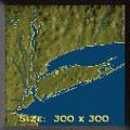
Goal: The Tri-state region is in it's infancy, yet abondant in resources. Expect New York city's bad reputation to cause some problems along the way to riches.
Author's Comments: Your goal is to SOLE SURVIVING company in the Tri-state area, and connect Montauk, Midtown Manhattan, and Hartford.
--
For the bronze do this in 30 years
--
For the silver accomplish this in 20
--
And the gold, complete both in 20 years and have a company book value of $50,000,000.
By Guest165 0 -
Goal: Gray's Harbor is a small port on the coast of Washington USA. Easy map for bronze.
Simple 10 year goal:
Survive and make a profit for the Gray's Harbor Lumber Company.
Author's Comments: Gray's harbor in on the coast of Washington state. Logging.
The map will use dialogs for giving instructions.
By Gwizz121 0 -
Goal: The time for starting a new railroad has long past. But you will elbow your way into the tycoons club to get your share.
Author's Comments: Realistically by the 1920s you would not find many cities that were not connected by viable railroads. So you must compete on an unfair footing with established companies. You are given a chance to open your own railroad line or invest in stocks.
The major step is to become CEO of one of the existing RRs. When this is done the final goal is much easier. It is possible to win. I won silver in under 10 years by taking control (on considerable margin) of Penn RR. It was a matter of time before I win gold.
If you find errors in spelling or events let me know so I can fix them.
Hint: Play the game several times but watch which railroads come out of the gate fast. And which are slow but powerful giants. I invested in a fast starter and took over a slow giant for my win.
By Guest156 0 -
Goal: Cube is the biggest of the Caribbean Islands. Its economy is mainly based on sugar cane and other agricultural products.
Author's Comments: Cuba is the biggest of the Caribbean Islands. Its economy is mainly based on sugar cane and other agricultural products, Such as tobacco, cotton produce and cattle. In the southern part of the island, there are some nickel (in this game bauxite) and some iron. There is no coal in Cuba, and only a few oil wells is placed in the northern part of the country.
I suggest the player to start with a small railway from Havana, just the same that happened in the real world. It will take some years to consolidate your company, but soon the expansion will escalate. By 1910 or so, the whole system should be built, and by this time it will take approximately 90 trains to run it. Note: No electric or diesels are available before 1957. By this time there are no more steam engines for sale.
By Guest163 0 -
Goal: Welcome to the Windy City...
The City of Big Shoulders...
Chicago, that toddlin' town!
Author's Comments: Chicago, Illinois, has been a major rail junction since the 1860s. The city was first settled because there was an easy portage from the Chicago River to the Des Plaines River that allowed trade to flow between the Great Lakes and the Mississippi River system. When railroads came to prominence at the expense of boat traffic on the rivers, Chicago was already a significant center of commerce, and its location at the south end of Lake Michigan not only made it a logical place for a port, but the terrain also dictated that all east-west lines into the upper Midwest had to come through Chicago on their way around the Great Lakes.
THAT TODDLIN' TOWN begins in 1890, and the Chicago area is already thick with railroads. Your job is to make good on an idea that didn't quite work in the real world: a ring railroad serving the outlying communities of the Chicago area. The Elgin, Joliet, and Eastern really did flourish for a few decades around the turn of the Twentieth Century, but it is now reduced to a shadow of its former self. It does, however, retain the distinction of being the only railroad that has junctions with all the major railroads serving Chicago, and it turns steady business shunting freight from road to road.
To avoid the fate that has befallen the real EJ&E, you'll have to invest heavily in profitable industries and establish a connection to Chicago. There are so many railroads doing business in the Windy City that it's probably not worth your while to try to capture passenger and mail traffic -- the idea is to exploit the city's pent-up demand for food, alcohol, and other commodities manufactured by the EJ&E's subsidiary industries.
As the Chicago market is already saturated, you cannot start a new company, though you can get yourself fired if you're not aggressive enough. The AI companies are presumed to connect to cities beyond the edge of the map and therefore receive a sizable annual "subsidy" above and beyond the revenue they generate from the trains you can see. This is actually counter historical, as a lot of railroads went broke in the 1890s. Even some of those represented in this scenario flirted with bankruptcy, though they later made their marks on history to some degree or another.
By Guest217 0 -
Goal: Map #1 (20th Century Limited): Recreate the competition between New York Central, Pennsylvania RR, and Baltimore & Ohio for passenger traffic between the East Coast and the Midwest.
Map #2 (Broadway Limited): Recreate the competition between New York Central, Pennsylvania RR, and Baltimore & Ohio for passenger traffic between the East Coast and the Midwest.
Map #3 (Capitol Limited): Recreate the competition between New York Central, Pennsylvania RR, and Baltimore & Ohio for passenger traffic between the East Coast and the Midwest.
Author's Comments: A map dedicated to the great Limiteds that ran in the eastern part of the U.S. during the 20th Century.
Acknowledgements: The map is based on Poptop's (www.poptopsoftware.com) campaign map #2 for the Classic Campaign; the idea for the scenario came out of two articles in Classic Trains Magazine (www.classictrainsmag.com), Winter 2002, p. 22-37.
Compatability: Runs with the "The Second Century", "Gold", and "Platinum" editions of Railroad Tycoon II.
Players: Multiplayer and single player.
Objective: Haul the most passengers and mail between the major cities of the East Coast (New York City, Philadelphia, Baltimore, and Washington, D.C.) on the one hand, and Chicago and St. Louis, on the other. If your company had the highest average speed of all railroads in any year, loads hauled between these places during that year count double.
Duration: 30 years, with start years ranging between 1902 and 1940.
Victory Conditions: Multiplayer - haul the highest number of loads between East Coast and Midwest cities. Single Player - Bronze: haul the highest number of loads between East Coast and Midwest cities; Silver: haul at least 400 loads between these places; Gold: haul at least 600 loads.
Versions: This map comes in three versions that differ as to what railroad company the human player chairs in a single player game; and as to the order of the player characters in a mutliplayer game.
By Guest170 0 -
Goal: It's the Year of Our Lord 1881, and the contract to build the Canadian Pacific Railway is finally in the hands of private enterprise. As head of the CPR Syndicate, can you fulfill the National Dream?
Author's Comments: This is map two of the player built campaign map series. It tells the history of the building of the Canadian Pacific Railway from 1881 to 1886 after the government of Canada gave it up to private enterprise. The major players were president George Stephen, Prime Minister John A. MacDonald, general manager William Van Horne and many other supporting characters.
Creating this map has been a labour of love for me, being based on my home country of Canada and my love of history. Almost all events are based on actual events in the history of the building of the Canadian Pacific Railway. Historical information is all from Pierre Berton's book The Last Spike. For you history buffs, here are some events and where they are found in that book:
p.6 - Passing of the Pacific Railway bill.
p.50,51,325 - The monopoly clause.
p.162,163 - Payment of the subsidy.
p.19 - Hiring of Major A.B. Rogers to survey the western passes.
p.19,108 - Choice of Kicking Horse Pass route.
p.62 - Hiring of Van Horne.
p.116 - Van Horne's promise to lay 500 miles of track.
p.66-96 - Manitoba land booms.
p.99-100 - Red River flood and Winnipeg bridge collapse.
p.126,264 - Hiring of Michael Haney as superintendant in east and west.
p.159-160 - Prime Minister's request to build in Superior section.
p.52,161,497 - Buying of Quebec railway for access to Montreal and pressure to lease line to Quebec City.
p.290.362 - Track-laying record set.
p.256,263 - Hiring of Chinese coolies by Onderdonk.
p.299-302 - Trouble in Blackfoot territory and Father Lacombe.
p.323 - Request for government loan.
p.359 - Sudbury mineral discovery.
I'm sure there are many more that I've overlooked.
Geographically speaking, the map was made from a pcx file created using GeoVu with coordinates of -71W to -131W longitude and 40N to 60N latitude. I tried to add as many lakes and rivers as I could to make it more realistic, so I probably overdid it, but I like it that way.
This map is dedicated to my family, some of whom I have named in features of the map where these exist in real life. For fun, see if you can find these names: Carman (my dad), Christina (my mom), Lois, Steven, Gary, David, Corinne and of course Gross. (Sorry to the others, couldn't fit you in :)
By Guest216 0 -
Goal: Build transportation to all regions of the Pine Valley.. and victory will be yours!
Author's Comments: This is a map of Pine Valley, an isolated industrial area in the Northwest United States. Unify the valley and win the gold.
By Guest143 0 -
Goal: Help the Big Apple get bigger. Semi-accurate map of the greatest city in the world.
Author's Comments: Semi-accurate recreation of New York City!
NOTE: This map starts in 1900 but ends in 1899, meaning you will get a message saying you lost as soon as you start.
By Guest171 0 -
Goal: Washington State a land rich in natural resources. Test your railroad baron skills against turn of the century expansionism.
Author's Comments: This is a complete map of the state of Washington with cities, towns, mountains, rivers, and ocean. It can be started from 1870-1999. I decided not to make winning-losing conditions but rather make it somewhat historical by adding railroad events that happened over time in the state. I also have promotional $$$ for first to connect Seattle to Portland and Seattle to Spokane.
Please feel free to expand on this map as you see fit. Just don't try and use it to make money for yourself.
By Guest152 0
