About This File
Goal: It's the Year of Our Lord 1881, and the contract to build the Canadian Pacific Railway is finally in the hands of private enterprise. As head of the CPR Syndicate, can you fulfill the National Dream?
Author's Comments: This is map two of the player built campaign map series. It tells the history of the building of the Canadian Pacific Railway from 1881 to 1886 after the government of Canada gave it up to private enterprise. The major players were president George Stephen, Prime Minister John A. MacDonald, general manager William Van Horne and many other supporting characters.
Creating this map has been a labour of love for me, being based on my home country of Canada and my love of history. Almost all events are based on actual events in the history of the building of the Canadian Pacific Railway. Historical information is all from Pierre Berton's book The Last Spike. For you history buffs, here are some events and where they are found in that book:
p.6 - Passing of the Pacific Railway bill.
p.50,51,325 - The monopoly clause.
p.162,163 - Payment of the subsidy.
p.19 - Hiring of Major A.B. Rogers to survey the western passes.
p.19,108 - Choice of Kicking Horse Pass route.
p.62 - Hiring of Van Horne.
p.116 - Van Horne's promise to lay 500 miles of track.
p.66-96 - Manitoba land booms.
p.99-100 - Red River flood and Winnipeg bridge collapse.
p.126,264 - Hiring of Michael Haney as superintendant in east and west.
p.159-160 - Prime Minister's request to build in Superior section.
p.52,161,497 - Buying of Quebec railway for access to Montreal and pressure to lease line to Quebec City.
p.290.362 - Track-laying record set.
p.256,263 - Hiring of Chinese coolies by Onderdonk.
p.299-302 - Trouble in Blackfoot territory and Father Lacombe.
p.323 - Request for government loan.
p.359 - Sudbury mineral discovery.
I'm sure there are many more that I've overlooked.
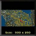
Geographically speaking, the map was made from a pcx file created using GeoVu with coordinates of -71W to -131W longitude and 40N to 60N latitude. I tried to add as many lakes and rivers as I could to make it more realistic, so I probably overdid it, but I like it that way.
This map is dedicated to my family, some of whom I have named in features of the map where these exist in real life. For fun, see if you can find these names: Carman (my dad), Christina (my mom), Lois, Steven, Gary, David, Corinne and of course Gross. (Sorry to the others, couldn't fit you in :)


Recommended Comments
There are no comments to display.
Join the conversation
You can post now and register later. If you have an account, sign in now to post with your account.
Note: Your post will require moderator approval before it will be visible.