
About This File
Goal: The railway boom has finally reached Ontario's northeastern frontier.
Population centres are small and spread out, but there's lots of forestry and mining out there. The problem is building through the wilds of the Canadian Shield and the swampy muskeg of the Sub-Arctic to link it all together. It's tough making a railway fortune out here - give it a shot anyhow!
This is an open map with no events or goals, just make money and beat your competition.
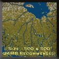
The map was created using satellite imagery and is reasonably accurate. Industries are set in appropriate centres and regions but:-
1) Aluminum/Bauxite = Nickel/Copper mining
2) Iron Mines = Iron/Zinc/Cobalt/Gold mines
3) Limited agriculture is accurate but pre-set in the smaller regions where it is found.
4) Snow around James Bay represents the added expense involved in laying rail in muskeg (snow is not year-round up there).
Recommended Comments
There are no comments to display.
Join the conversation
You can post now and register later. If you have an account, sign in now to post with your account.
Note: Your post will require moderator approval before it will be visible.