
About This File
Goal: The Red Island. Rails in the Indian Ocean.
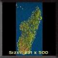
Author's Comments: Created from the TerrainBase collection, converted to greyscale in GeoVu before being despeckled, blurred and resampled to 251x500 pixels in Photoshop 5. Because Madagascar elevations start at 119 feet, I had to manually add coastal areas, especially in the northwest, west, far northeast and far south west, as well as a coastal strip the length of the eastern coast. (Tip...when doing this, add key rivers in BEFORE adding coastlines, then you can clearly see where key estuaries are, AFTER you add land - not as easy as it sounds).
Towns in the north and east and west coast are fairly accurate. The exact location of Tana, Antsirabe and inland towns are a bit more difficult (could do with a real map editor to be able to input towns by real co-ordinates).
In time I hope to add more villages, especially in the south and south west, and events to create a proper scenario.
Recommended Comments
There are no comments to display.
Join the conversation
You can post now and register later. If you have an account, sign in now to post with your account.
Note: Your post will require moderator approval before it will be visible.