About This File
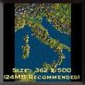
Goal: Italy's landscape is very varied. Develop the main railway lines and connect Italy to the other nations through the Alps passes.
Author's Comments: We began Italy.map on the 3rd of January 1999. One on PC and the other on the atlas. We could work only at the weekends and... we didn't know it would take so much time!
We used a 200 factor for elevating the mountains: that's the reason why you see very high mountains, and why we spend so much time in smoothing terrain! It will be very difficult to make the railways reach the Alps passes without overcoming a 2% slope! In fact in the past in the Alps a lot of the most long tunnels in the world were excavated.
We introduced the most important cities of Italy and of the near nations, respecting the real industrial configuration. You may find that there are too many cities, but the criterion we used was to place all of the Italian province chief towns according to this rule:
Population = <25000 --> Size = Village
Population = <50000 --> Size = Town
Population = <200000 --> Size = City
Population = <1000000 --> Size = Metropolis
Population = >1000000 --> Size = Megalopolis
Moreover we have enlarged many valleys in order to make the main railway lines pass; for this reason you can see that the nation boundaries aren't very precise.
If you find serious problems in connecting two cities following a real path, please inform us. If you like to change some idea about Italy.map and RT2 in general, please contact us.
We hope you enjoy Italy. Many people in the world would like to visit Italy: for them this map gives the occasion to see a simplified Italian landscape: from the snow on the Alps, to the cactus in Sicilia!
We thank Slap for his advices, and all the RT2 fans who choose this map to play with.


Recommended Comments
There are no comments to display.
Join the conversation
You can post now and register later. If you have an account, sign in now to post with your account.
Note: Your post will require moderator approval before it will be visible.