
About This File
Goal: A raw map of British North America with 1848 colony names and boundaries, suitable for any scenario commencing before Confederation.
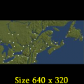
Author's Comments: This is a raw map of British North America (BNA) with 1848 colony names and boundaries, suitable for any scenario commencing before Confederation.
I am working on a scenario for this region that runs from 1836 to 1867. In the meantime, make your own, if you like.
The principal exports during this period were wheat, lumber, food and coal, as well as what is left of a slowly declining fur trade. The primary imports were goods and an assortment of products from the Caribbean. Cattle and meat appearing in the maritimes represent fresh then processed fish ready for export. The sugar appearing near Montreal is maple syrup. Barracks occur only in BNA to avoid the complication of troops crossing peaceful borders. The shortage of tool & die factories in BNA relative to USA gives you goods for the backhaul.
Recommended Comments
There are no comments to display.
Join the conversation
You can post now and register later. If you have an account, sign in now to post with your account.
Note: Your post will require moderator approval before it will be visible.