About This File
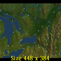
Goal: This is on PopTop's so-called Eastern Canada map, starting between 1850 and 1860. There has been about a 60 year cold spell following the battle for Quebec. After the War of 1812, the British, Americans and the Hudson Bay Company packed it in leaving the region to the Indians, some hardy British settlers and les Habitants. With HBC gone, La Compagnie Nord-Ouest is the only corporate entity in the region. Now that the world is getting warmer, the various groups are reaching out again to trade. They now seem less inclined to war given that most of their attention has been focused on simple survival.
As CEO of La Compagnie Nord-Ouest, you have 30 years to achieve the following:
Single player only:
Bronze - $40 million CBV.
Silver - $60 million CBV.
Gold - $80 million CBV and earn $6 million in revenue for deliveries to 5 of the 6 territories.
Author's Comments: This is a beta, so a lot of these comments are directed at fellow mapmakers.
The scenario was inspired by Voltaire's comments regarding France's loss of Canada that the region is 'nothing but a few acres of snow', and I started thinking, what if that were so?
The map has been recoloured. I am hoping to give an impression of the Canadian Shield being granite with a thin layer of soil. I would like to put a bit of snow on it but am still searching for a good technique.
Major tribes have their traditional areas. USA is east of the 1763 Royal Proclamation line. There was a mix of tribes in the Detroit area which I gave to the Potawatami on account of Pontiac's prominence in the early 1800s. Many cities were placed on the basis of 1740 and 1823 native population data. Since in this reality the Haudenosaunee (Iroquois) were able to keep their homeland, Brantford is considered non-existent, but the population was redistributed in Iroquois territory. Some sites are named after tribes. Where I did not know the tribe, I put the name of a river or a present day town.
Events include 1) famines caused by the brief return of cold weather, 2) a request to help arrange a peace / trade conference.
The people around the Great Lakes grew a lot of grain and produce, and there is potential to pickle the entire map in alcohol. I am hoping the famine events will help save some food from fermentation. Chiefs in this era where quite hostile to alcohol, so I may write some events in to limit booze. Loss of productivity or angry chiefs (loss of rights) or a failed conference are possibilities.
For hunting - gathering societies, I have towns with corn and meatpacker industries, with cattle in the hinterland. The corn serves as 'gathered' food and makes 'hunts' close to home more successful. For agrarian societies, I have a people-only region at a very high density, in a checkerboard pattern with a farm region, then setting the whole map at high density.
Enjoy, and please get back to me with comments!


Recommended Comments
There are no comments to display.
Join the conversation
You can post now and register later. If you have an account, sign in now to post with your account.
Note: Your post will require moderator approval before it will be visible.