About This File
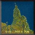
Goal: Far North Queensland has a diverse landscape. From Bauxite around Weipa, the Rainforests of the Daintree, the Sugar Plantations of the coast and the Mines of Mount Isa offer a variety of options to explore.
Author's Comments: This is my first attempt at using the RRT2 editor. At first all I wanted to do was experiment but it ended up being a complete MAP. I actually learnt quite a bit about Queensland's history in planning the map. (like the fact that there was once a plan to form 3 separate states before the turn of the century.)
The scenario is based on the area immediately to the north of Townsville <-> Mt Isa (also known as the Great Northern Line) I have never been north of Rockhampton so I cannot be certain of many of the landscape details.
Much of the landscape is a rough approximation from the 1 to 1 million Topographic series & some 1960's vegetation maps.

Recommended Comments
There are no comments to display.
Join the conversation
You can post now and register later. If you have an account, sign in now to post with your account.
Note: Your post will require moderator approval before it will be visible.